Module I: Spatial urban energy system platform
This module establishes urban energy infrastructure. It extracts, acquires and processes urban geo-referenced data extracted from OpenStreetMap. In order to extract the OpenStreetMap georeferenced datasets of urban energy infrastructure and its required features, this module derives an automatised extraction procedure. Firstly, the raw OpenStreetMap data is downloaded from the OpenStreetMap database for the investigated urban space from Geofabrik. Second, the OpenStreetMap datasets are filtered for the respective case study defined by a .poly file using osmosis, an open source java tool. The OpenStreetMap data are filtered for the following OSM tags: landuse, building, and highway.
Note
- landuse:
provides information about the human use of land in the respective area (see Figure 1)
- building:
describes all mapped objects considered as buildings of different types. e.g houses, schools, etc. (see Figure 2)
- highway:
describes all lines considered as streets, roads, paths, etc. (see Figure 3)
After filtering the OSM raw data, the geo-referenced building and highway infrastructure (case study: the city of Oldenburg) are exported to a relational postgis-enabled database using the open source osm2pgsql. Theses datasets can be exported as .csv files or visualised as maps (see Figures 1-3).
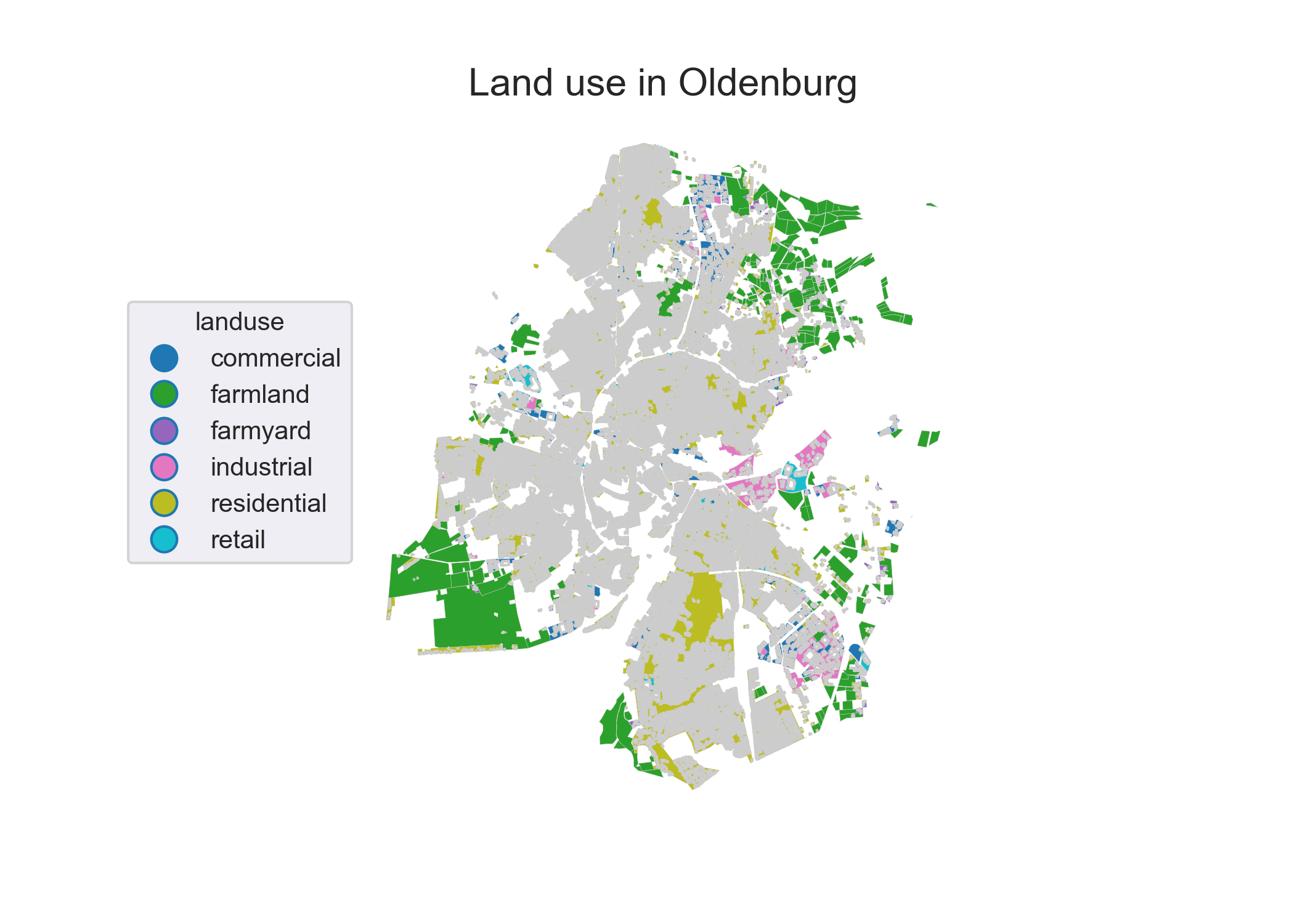
Extracted OpenStreetMap landuse datasets for the city of Oldenburg. Credits: OpenStreetMap contributors.
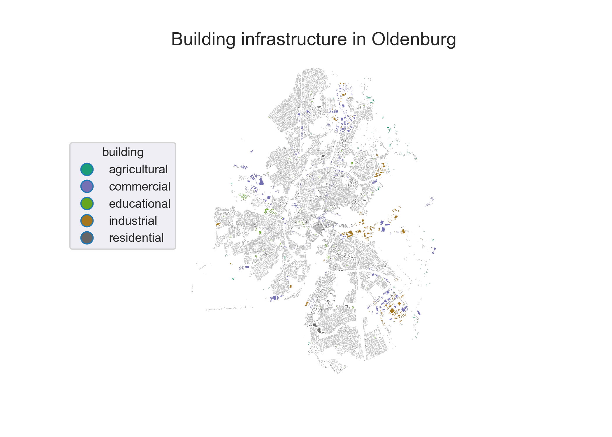
Extracted OpenStreetMap building datasets for the city of Oldenburg. Credits: OpenStreetMap contributors.
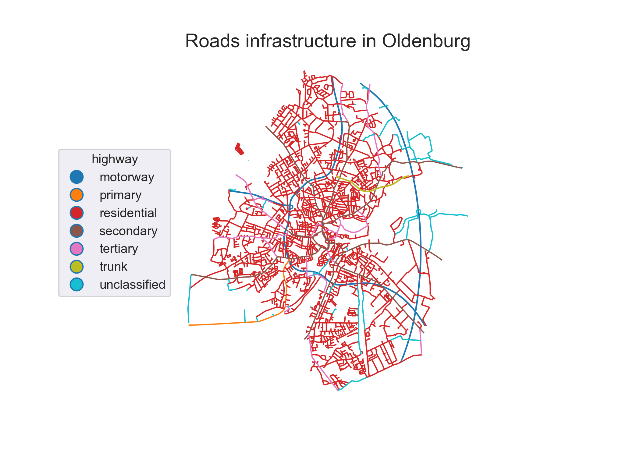
Extracted OpenStreetMap highway datasets for the city of Oldenburg. Credits: OpenStreetMap contributors.